
Landscape Architects in the Conversation of Advanced Geospatial Technologies
Nowadays, everyone has easy access to geospatial information through smart devices. The way we experience and interact with our urban environment has changed dramatically. For example, you can learn about trees you see at a park, their name and characteristics (e.g. Singapore, New York); you can report what wildlife you spotted in your neighborhood and share it through an App (e.g. Bioatlas). Thanks to advanced technologies and creative IT solutions, we can easily foresee more and more ways to involve the public in the process of landscape and urban planning. What ideas can you think of? Here introducing ongoing 2 examples; one that focuses on risk mitigation for urban floods; and potential application of Augmented Reality in spatial design.
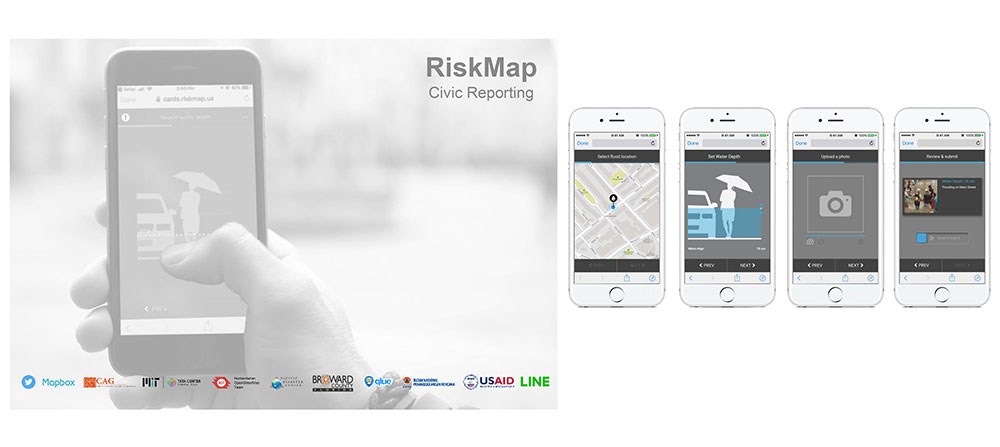 Img1 RiskMap uses simple steps for citizens to submit time-critical posts onto an online map without needing training or installation of Apps. Image Credit: MIT Urban Risk Lab.
Massachusetts Institute of Technology’s Urban Risk Lab has introduced an online platform; RiskMap that harnesses the social media to collect, sort and analyze disaster data. In case of heavy rain, real-time, geo-tagged warning posts from the public (flooding depth, embankment failure etc.) will be mapped out instantly to notify areas with higher risks.
Besides RiskMap being an effective risk disseminating device during flood events, in the long run, this process of data gathering should contribute raising public awareness of natural disasters, and at the same time, provide useful data for the policy makers to take mitigation actions.
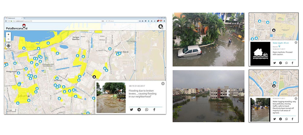
Img2 This platform was used extensively by residents and the government during February 2017 flooding in Jakarta. There were 500,000 views within 24 hours. Image Credit: MIT Urban Risk Lab.
Another example is to apply Augmented Reality technology in the planning process. As shown in Img3, utilizing advanced GPS technologies and 3-dimensional geospatial data, it is possible to overlay annotation, simulation and your proposals to the actual world. This concept can be a powerful tool for community engagement process, especially when your audience is not familiar with technical plans and sections.
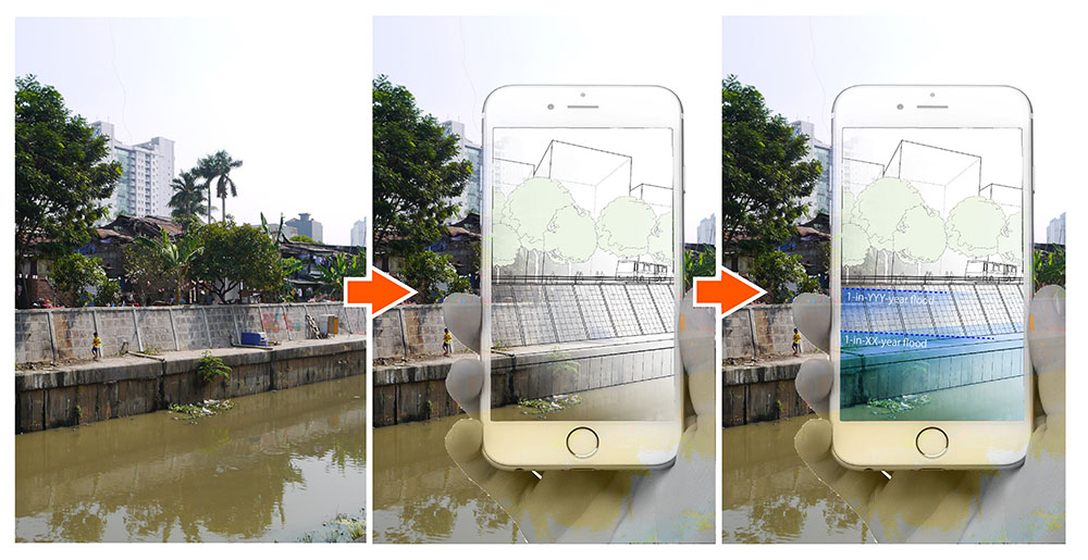
Img3 Concept of showing neighborhood’s future through smart phones by overlaying building, infrastructure and water movement. Image Credit: Author.